Housatonic Range Trail-Candlewood Mountain Trail-Tory's Cave-Candlewood Trail


route of candlewood trail approx. 1950....drinking was permitted... route of candlewood trail approx. 1950....drinking was permitted... route of candlewood trail approx. 1950....drinking was permitted...


Budweiser


This Trail seems to be getting to be called Candlewood Mountain Trail. The Housatonic Range Trail is an OLD Trail which has been part of the Connecticut 'Blue Blazed' Trail System. It is on private property and it seems it is gradually being chipped down to a fraction of it's old route. In my opinion the most beautiful and rural was the walk up Boardman Mountain. Unfortunate, as the some of the best locations are now lost. Suicide Rock can be found on 'antique' postcards. I do not see that name on a map now. Candlewood Cave is now called Tory's Cave.

I never saw much as to Tory's Cave but a BIG hole in the ground that might contain ice in the hot summer. Search the web. It seems the cave has been reduced with time and there honestly is something down there to those that dare try to fit down. A side Trail goes to the cave. It was once an easy hike from US Route 7 but not too sure as to parking now. (ps..2010 there is parking off Rt.7 down the hill from the cave) My experience has been DO NOT CLIMB IN/DOWN CAVES AND MINE SHAFTS, ETC. !!!


route of candlewood trail approx. 1950....drinking was permitted...


Above image is the Trail in the late 1960's


route of candlewood trail approx. 1950....drinking was permitted... route of candlewood trail approx. 1950....drinking was permitted... route of candlewood trail approx. 1950....drinking was permitted... route of candlewood trail approx. 1950....drinking was permitted... route of candlewood trail approx. 1950....drinking was permitted...


Trail as of 1997


The Housatonic Range Trail follows the general route of an Indian Trail above the Housatonic River, parallel to US RT.7. A day hike includes some steep climbing and a few areas of rough scrambling through hedges and boulders. The trail is crossed by RT 37 and Squash Hollow Road in two locations.

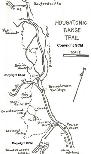
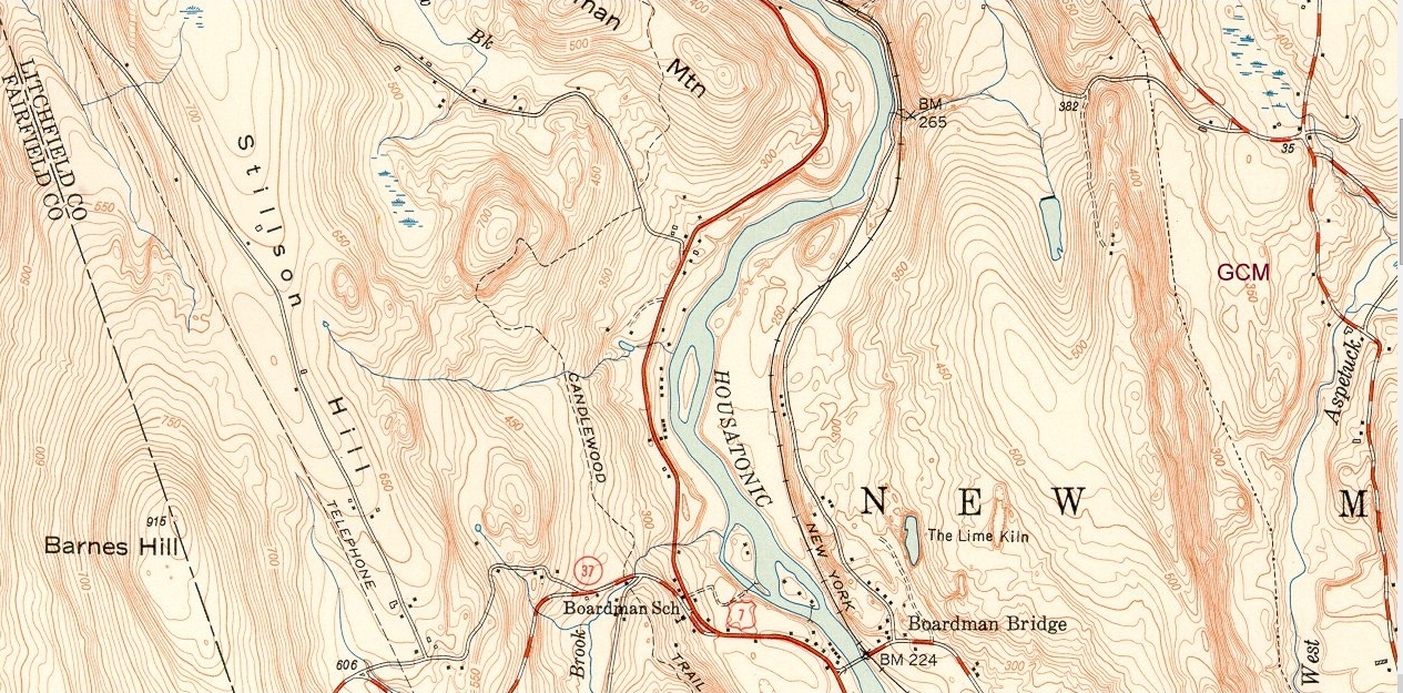
The trail follows a ridge and connects near the summit with a shorter loop trail around to Kelly's Slide. It ends at the summit of Candlewood Mountain, 1.47 miles from the trailhead on RT 37. Parking for several cars at entry to Stilson Hill development, just north of junction of RT 37 and Candlewood Mountain Road. Parking also available adjacent to the old Gaylordsville cemetery near the northern end of the trail.


Blue Blazed


North to South


0.0--From Gaylord Road descend 150 feet and cross bridge over brook

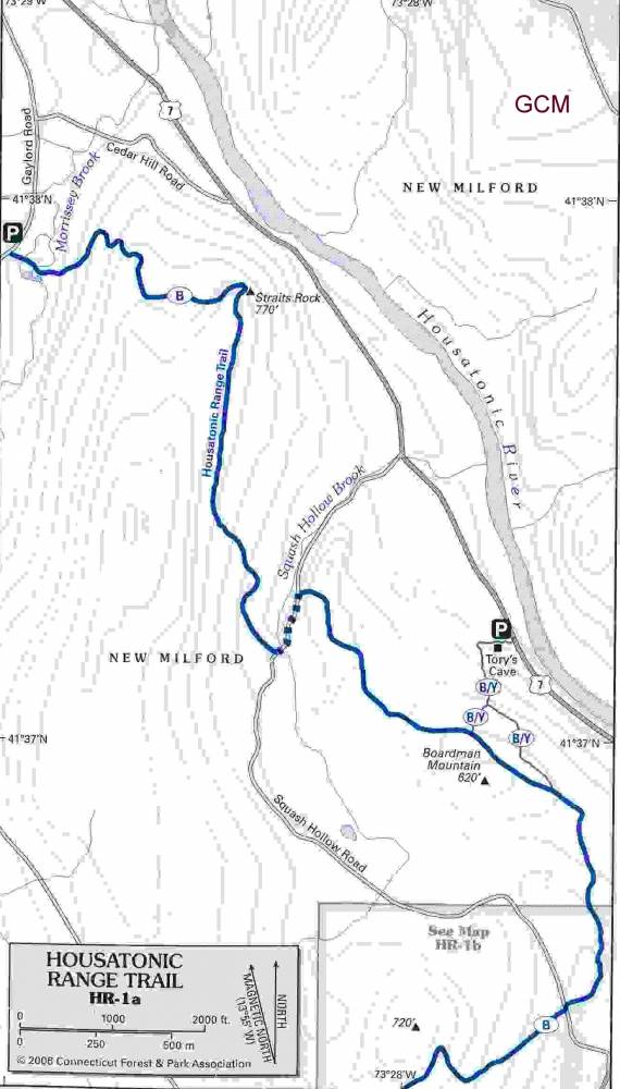
0.25--Turn Right and begin climb up and over short switchback and down across woods road

0.51--Cross seasonal stream bed and begin ascent over boulders at Straits Rock

0.75--Trail reaches Pinnacle, a large, flat rock above Straits Rock, and gradually descends to the northern intersection of Squash Hollow Road

1.80--Turn left on Squash Hollow Road for 0.2 miles, cross road and continue south. Trail climbs immediately for 300 feet then levels off

2.45--Pass north fork trail to Tory Cave on left

2.70--Pass south fork trail to Tory Cave

3.30--Cross southern intersection of Squash Hollow Road. Continue south past stone wall and begin steep ascent to the top of Suicide Ledges.

3.8--Descend over ledges and past small stream to RT 37 and parking area

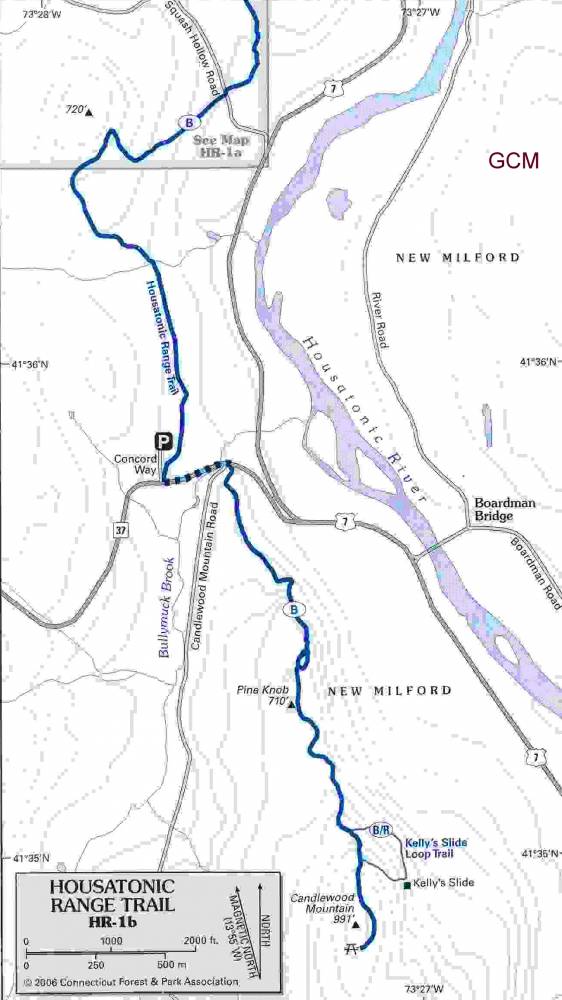
4.35--Turn left on RT 37, head east for 0.2 miles and cross road corner of Candlewood Mountain Road.

4.55--Enter woods next to large boulder and head south through mixed hardwoods and evergreens for 0.25 miles to where trail is interrupted by pipeline cut.

4.85--Trail reaches rock ledges and small overlook with cathedral white pines, then passes seasonal runoff and turns left for 100 feet. Turn right and head south parallel to ridge

5.05--Ascend 50 degree ledge, after which trail appears to split right. Stay left and climb through 'corkscrew', an interesting fold of steep ledges and boulders. (very slippery when wet)

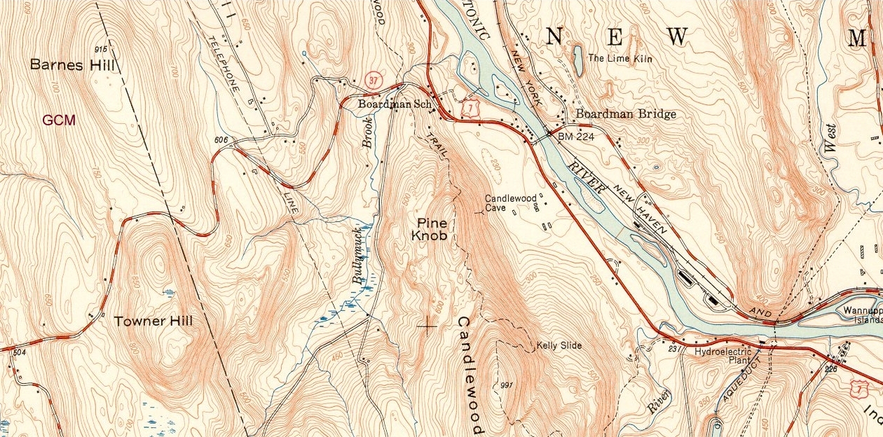
5.30--Trail reaches summit of Pine Knob and crosses Paradise Valley, a saddle between Pine Knob and Candlewood Mountain

5.65--Trail follows up and over tumbledown boulder wall, framed to west by mountain laurel

5.70--Sign and trail for Kelly's Slide branching off to east. Follow trail 0.4 miles around low angled exposure of ledge with view of the Housatonic River

6.02--Candlewood Mountain summit (991 feet) and END OF TRAIL.


this can was found on boardman mountain. Used by a legal drinker I presume


go back